The Project "flexRISK Poland"
Flexible tool for assessment of nuclear risk in Lubiatowo - Poland
For detailed project description please refer to the Final report, 68 MB PDF. If you have questions or want to make comments about any part of the project, please contact the project team.
Domain of the Project
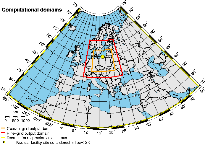
The map shows the three domains used in the project. The outermost domain (yellow line) shows the boundaries for the meteorological calculations. The next domain boundary (in orange) defines the region for evaluation of the results in a 12 km grid. In the region inside the smallest domain (red line) results will be evaluated on a finer 3 km grid.